The task
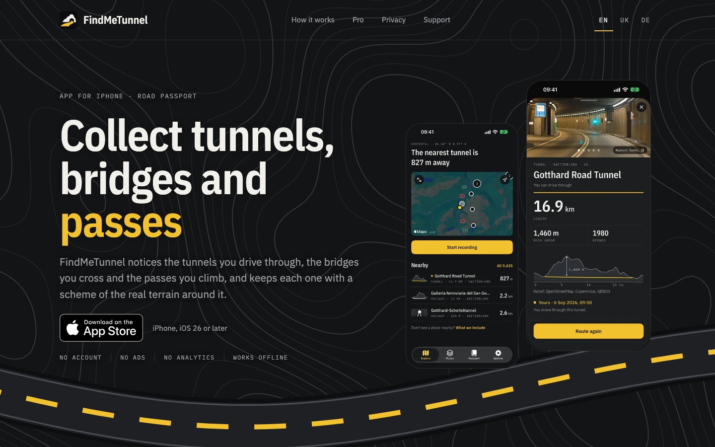
On a road trip you pass dozens of tunnels, bridges and mountain passes, and afterwards nothing remembers them. I wanted an app that notices them by itself and keeps each one, like stamps in a passport: without an account, without choosing anything on the road, and without making you stare at the phone.
Role
Idea, design, development, place data, App Store release
What I did
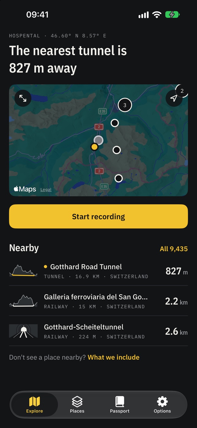
- Design and development for iPhone: press Start recording and go, by car, train, on foot or by bike. The app notices tunnels, bridges and passes on the route by itself, also while the phone is locked, and a Live Activity on the lock screen shows how far through a place you are. Recording starts and stops with Siri, too.
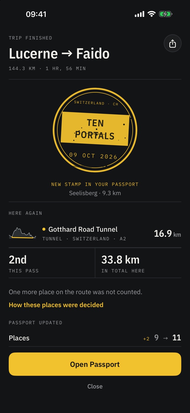
- A summary after every trip: the route on a map, new places, the kilometres spent underground and sometimes a new stamp. If a place was not counted, “How these places were decided” shows why, and you can count it by hand or remove a wrong mark, instead of the app pretending it is always right.
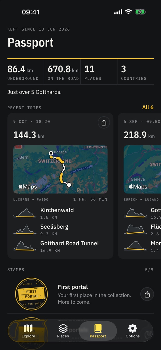
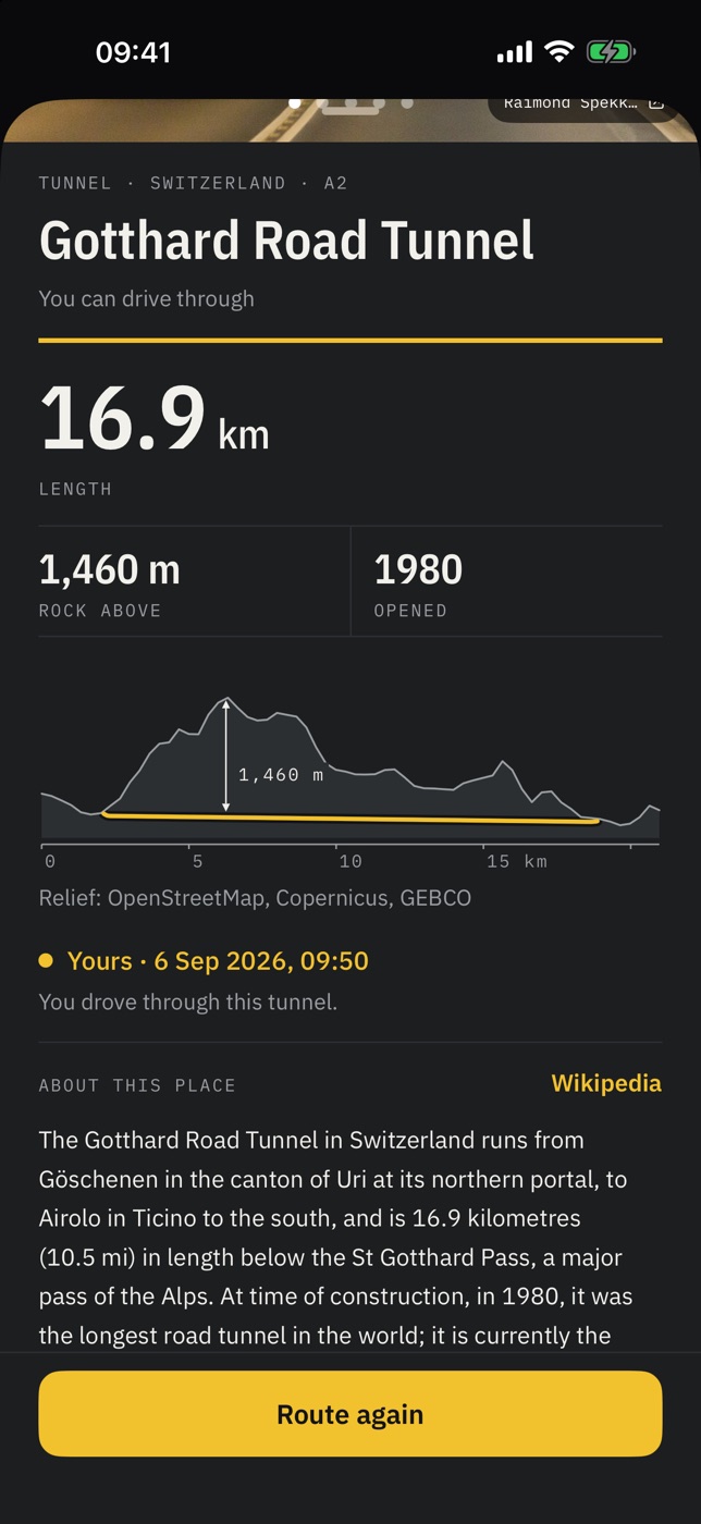
- A Passport with nine stamps, each printed like a real stamp on the day you earn it. Every place has its own scheme drawn from the real terrain: the rock above the Gotthard, the valley under a viaduct, every hairpin of a pass.
- The data is built from open sources: OpenStreetMap, Copernicus elevation data, Wikidata and Wikimedia Commons. 52 regions in Ukraine, Germany, Austria, Switzerland, Italy and France hold more than 9,400 tunnels and bridges, and all of them work offline with nothing to download.
- No account, no ads, no analytics: the Passport is copied to the person’s own iCloud and only they can see it. The interface in English, German and Ukrainian, a one-time Pro purchase for all regions and all trips, the landing page and everything for the App Store release.
Result
Released on the App Store on 5 November 2026. The app is free, Pro is a one-time purchase, with no account, no ads and no analytics.
Built with
Swift, SwiftUI, MapKit, Core Location, ActivityKit, App Intents, WidgetKit, StoreKit, HealthKit · OpenStreetMap, Copernicus, Wikidata, Wikimedia Commons